Drone survey and remote inspection

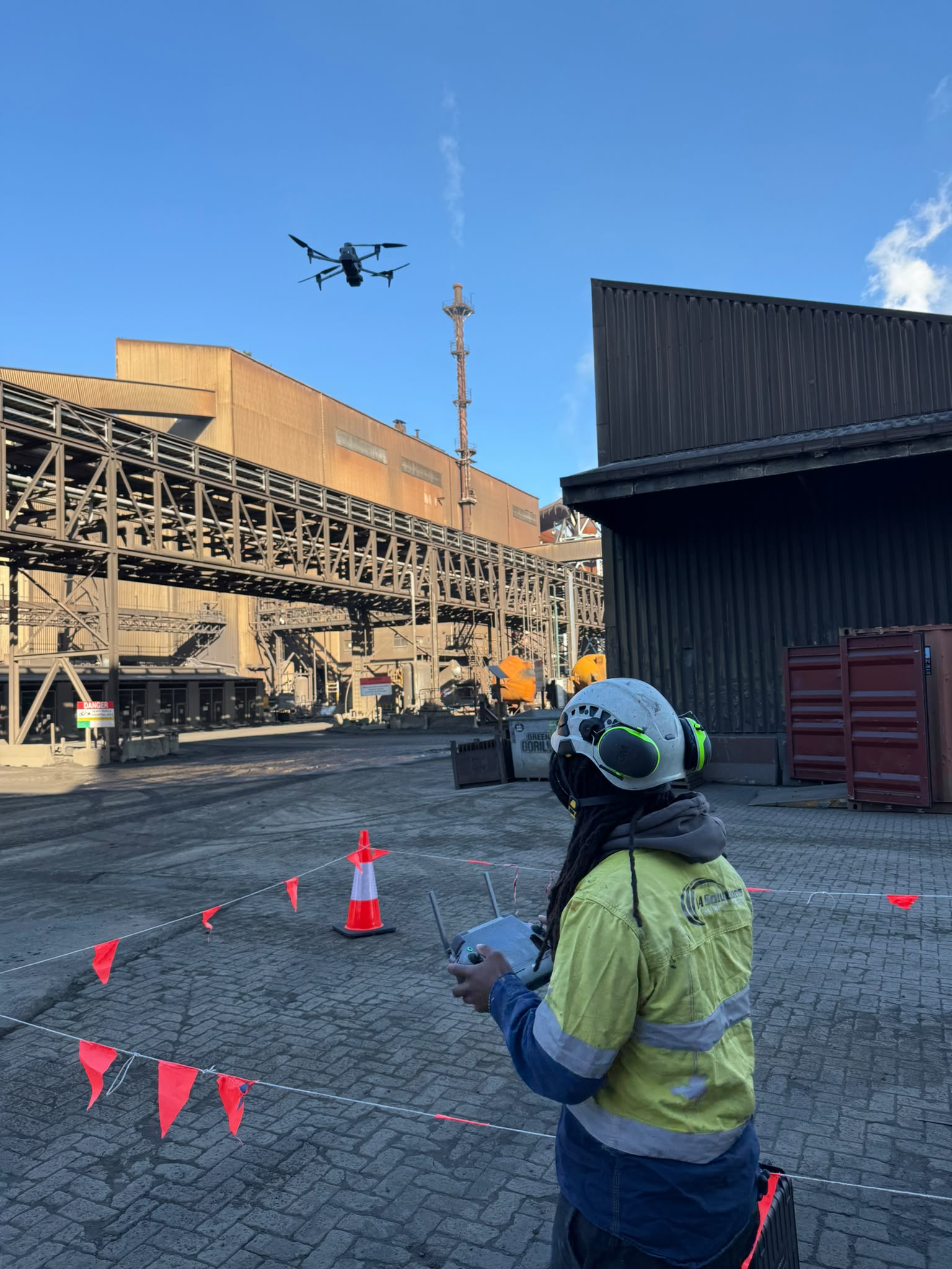
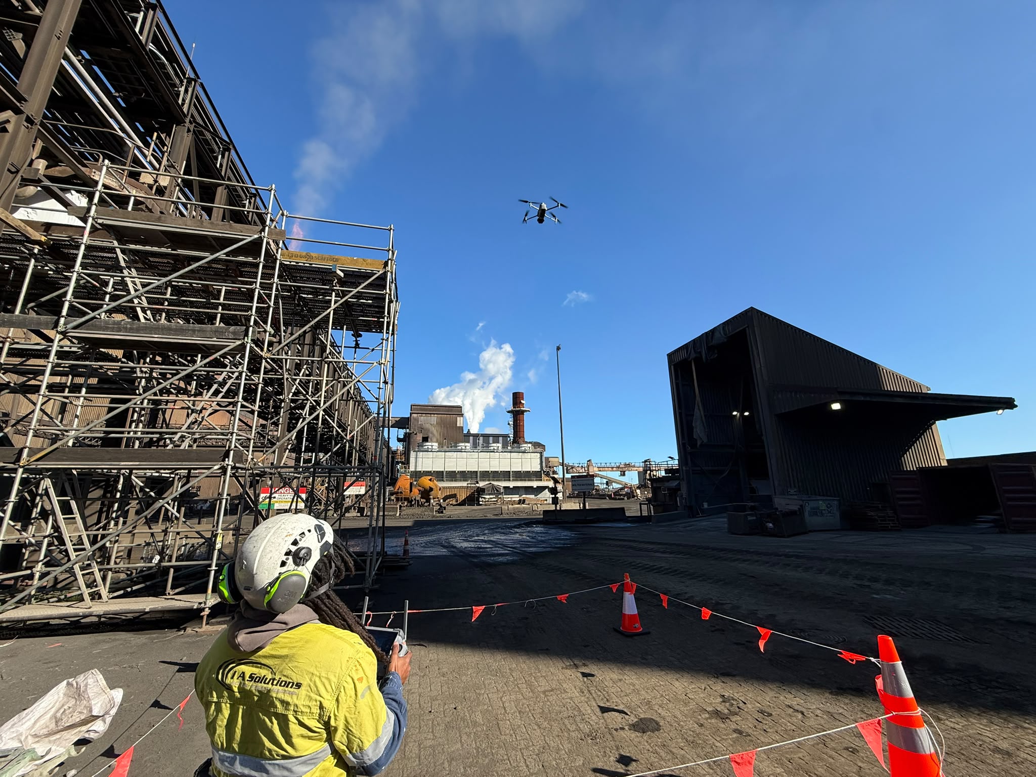
I.A Solutions delivers aerial survey of buildings, industrial assets and infrastructure, processed into 3D models and coded defect data rather than a folder of photographs.
Fill out the form to receive a call

Share your details and our team will be in touch to discuss your project.

What happens after the flight

A drone is quick to deploy and quick to produce a large volume of imagery. The value to an asset owner sits in what happens to that imagery afterwards. Our teams capture, then process the data into hosted 3D models, thermal maps and defect registers that can be compared year on year. Where a survey identifies something that needs a closer look, the same company can put a rope access technician on it.

Our drone capabilities

Aerial capture is the starting point. The deliverables below are what turn a survey into something an engineering team can plan against.

Capture

Aerial capture across assets too large or too awkward to cover efficiently on foot.

  • Drone inspection

  • Thermal imaging

  • 360-degree site capture

Capture

Aerial capture across assets too large or too awkward to cover efficiently on foot.

  • Drone inspection

  • Thermal imaging

  • 360-degree site capture

Capture

Aerial capture across assets too large or too awkward to cover efficiently on foot.

  • Drone inspection

  • Thermal imaging

  • 360-degree site capture

Processing and outputs

What the imagery becomes once it is off the drone. Models are hosted so your team and your engineers can work from a desk.

  • Photogrammetry and 3D modelling

  • Digital twins

  • Stockpile measurement and volumetrics

Processing and outputs

What the imagery becomes once it is off the drone. Models are hosted so your team and your engineers can work from a desk.

  • Photogrammetry and 3D modelling

  • Digital twins

  • Stockpile measurement and volumetrics

Processing and outputs

What the imagery becomes once it is off the drone. Models are hosted so your team and your engineers can work from a desk.

  • Photogrammetry and 3D modelling

  • Digital twins

  • Stockpile measurement and volumetrics

Ongoing asset management

Repeat capture that turns single surveys into a record of how the asset is changing.

  • Defect annotation and tracking

  • Repeat surveys and change monitoring

  • Remote engineer and architect reviews

  • Portfolio asset-management records

Ongoing asset management

Repeat capture that turns single surveys into a record of how the asset is changing.

  • Defect annotation and tracking

  • Repeat surveys and change monitoring

  • Remote engineer and architect reviews

  • Portfolio asset-management records

Ongoing asset management

Repeat capture that turns single surveys into a record of how the asset is changing.

  • Defect annotation and tracking

  • Repeat surveys and change monitoring

  • Remote engineer and architect reviews

  • Portfolio asset-management records

Construction progress surveys

Scheduled aerial capture through a build, giving the project team a dated visual record of progress and site conditions.

  • Scheduled progress capture

  • Site capture and documentation

  • Progress comparison over time

Construction progress surveys

Scheduled aerial capture through a build, giving the project team a dated visual record of progress and site conditions.

  • Scheduled progress capture

  • Site capture and documentation

  • Progress comparison over time

Construction progress surveys

Scheduled aerial capture through a build, giving the project team a dated visual record of progress and site conditions.

  • Scheduled progress capture

  • Site capture and documentation

  • Progress comparison over time

Assets we survey

Drone survey earns its place where the asset is too large to cover on foot, or too awkward to put a person on safely. We process the capture into hosted 3D models, thermal maps and coded defect registers that compare directly against the previous survey. Where something needs a closer look, we put a rope access technician on the structure.

Commercial buildings and towers

Commercial buildings and towers

Roofs and facades

Roofs and facades

Industrial plant and facilities

Industrial plant and facilities

Bridges and infrastructure

Bridges and infrastructure

Quarry, port and bulk storage

Quarry, port and bulk storage

Commercial and office buildings

Apartment and residential towers

Retail and mixed-use premises

Body corporate properties

Tanks, silos and vessels

Pipework and pipe supports

Chimneys, stacks and ducts

Gantry cranes and structures

Processing plant structures

An abseiler during repair work a steel bridge with a grinder
A technician working on the outside of a highrise building
An inspection being done by a rope access technician
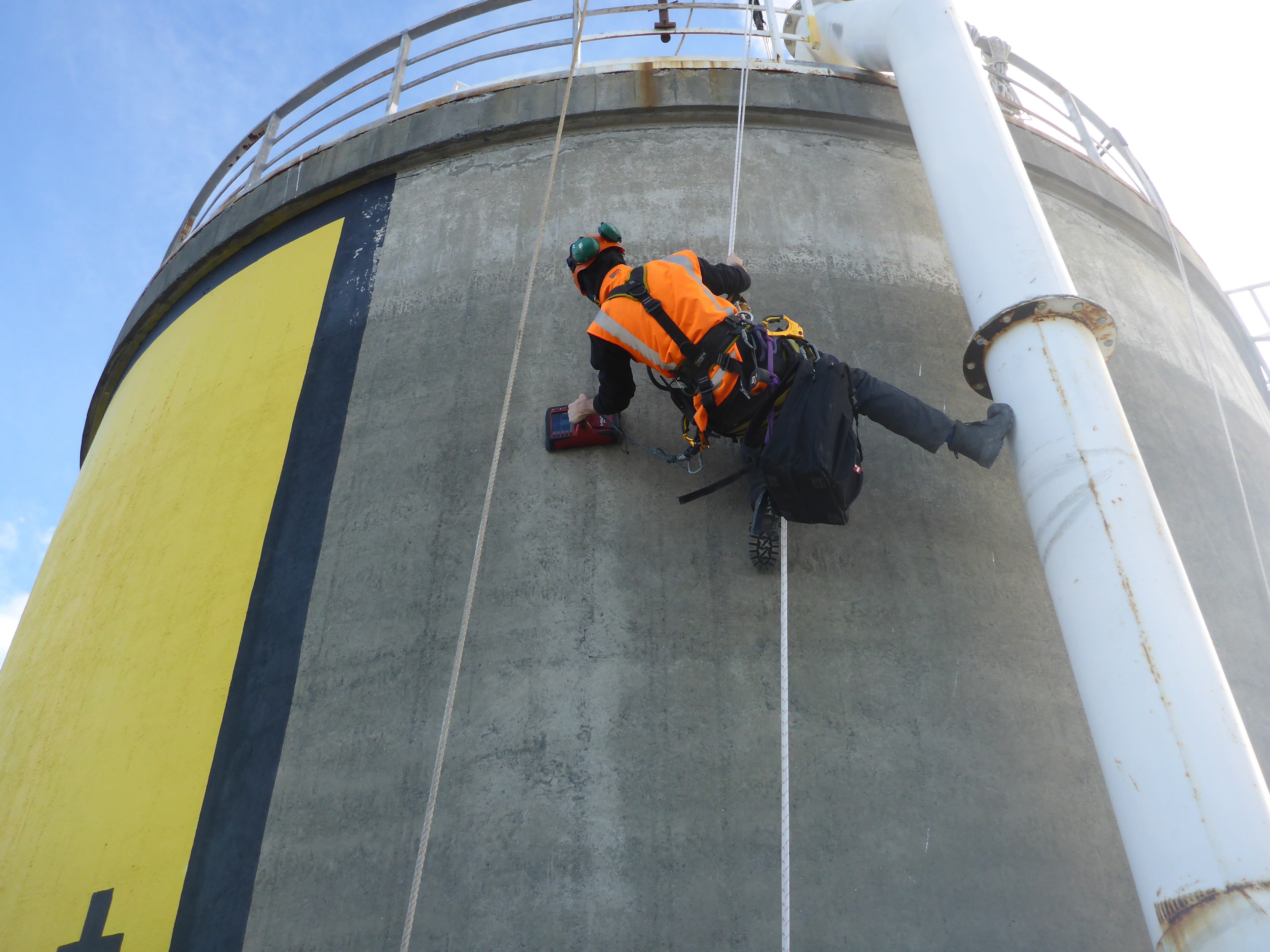
An absieler working on a large concrete tank

Examples of our projects and capabilities

See how we tackle some of New Zealand’s toughest access, inspection, and maintenance challenges. From high-rises to bridges and industrial plants, follow our latest projects and innovations in action.

Why asset owners choose us

Most drone providers deliver imagery. These are the differences between imagery and usable asset data.
Data, not photographs

You receive a hosted 3D model and a coded defect register your engineers can work from, rather than a drive full of images somebody still has to review.

Data, not photographs

You receive a hosted 3D model and a coded defect register your engineers can work from, rather than a drive full of images somebody still has to review.

Comparable year on year

Repeat surveys align against the previous capture, so the output is a rate of change rather than another isolated snapshot.

Comparable year on year

Repeat surveys align against the previous capture, so the output is a rate of change rather than another isolated snapshot.

Escalation to rope access

When a survey finds something that needs closer examination or repair, the same company puts a certified technician on the structure.

Escalation to rope access

When a survey finds something that needs closer examination or repair, the same company puts a certified technician on the structure.

Every flagged defect is reviewed

Automated detection completes the first pass across large image sets, then a qualified inspector checks each flagged item before it reaches the report.

Every flagged defect is reviewed

Automated detection completes the first pass across large image sets, then a qualified inspector checks each flagged item before it reaches the report.

Our accreditations

Aerial work is carried out in accordance with Civil Aviation Authority requirements for unmanned aircraft operations. I.A Solutions is Totika accredited and Impac Prequal assessed.
Our track record

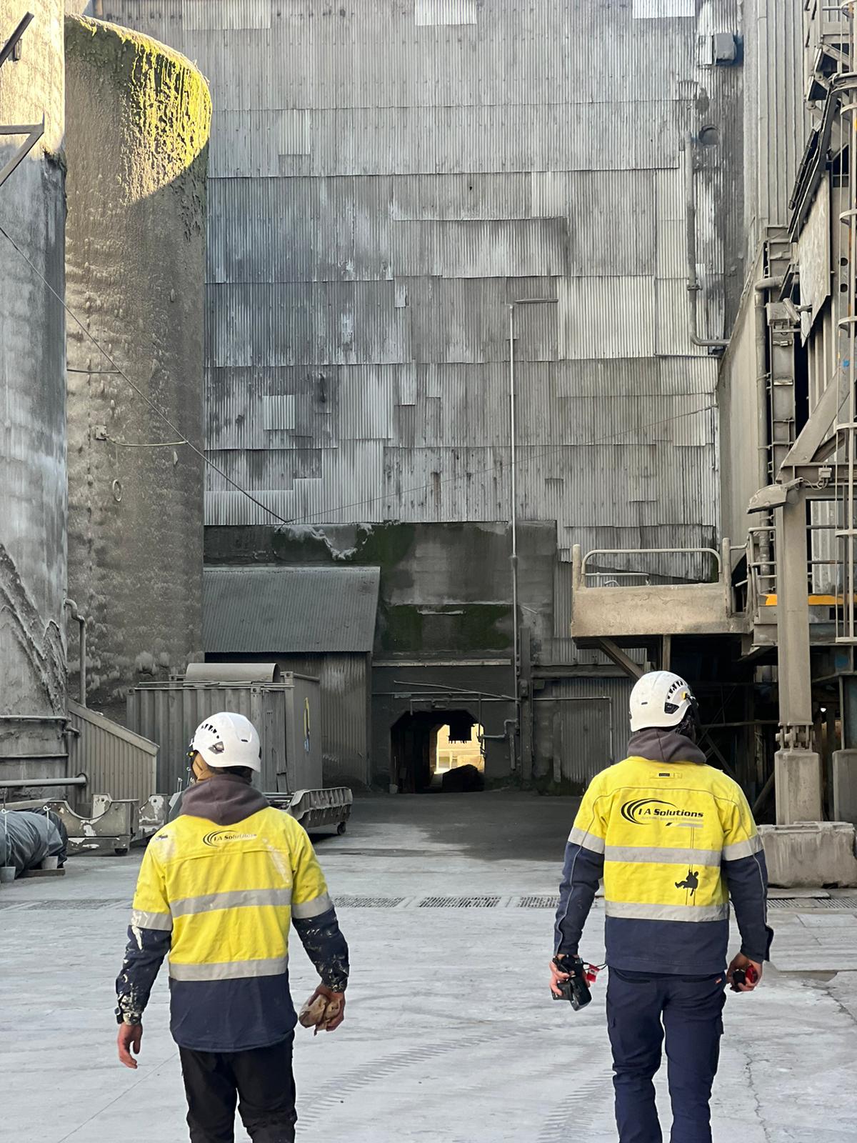
Fifteen years and 340+ projects completed across buildings, industrial assets and infrastructure. Survey findings are reviewed and reported by the same inspection personnel who deliver our rope access inspections.

Where we work

Our crews work regularly in Auckland, Wellington, Christchurch, Hamilton and Tauranga, and travel to sites throughout New Zealand. Where a client holds assets across several locations, we will plan a run of sites into a single mobilisation to reduce travel cost and downtime.
Our capabilities for your project are limitless

Discover our streamlined process for providing all your needs for your project or building.
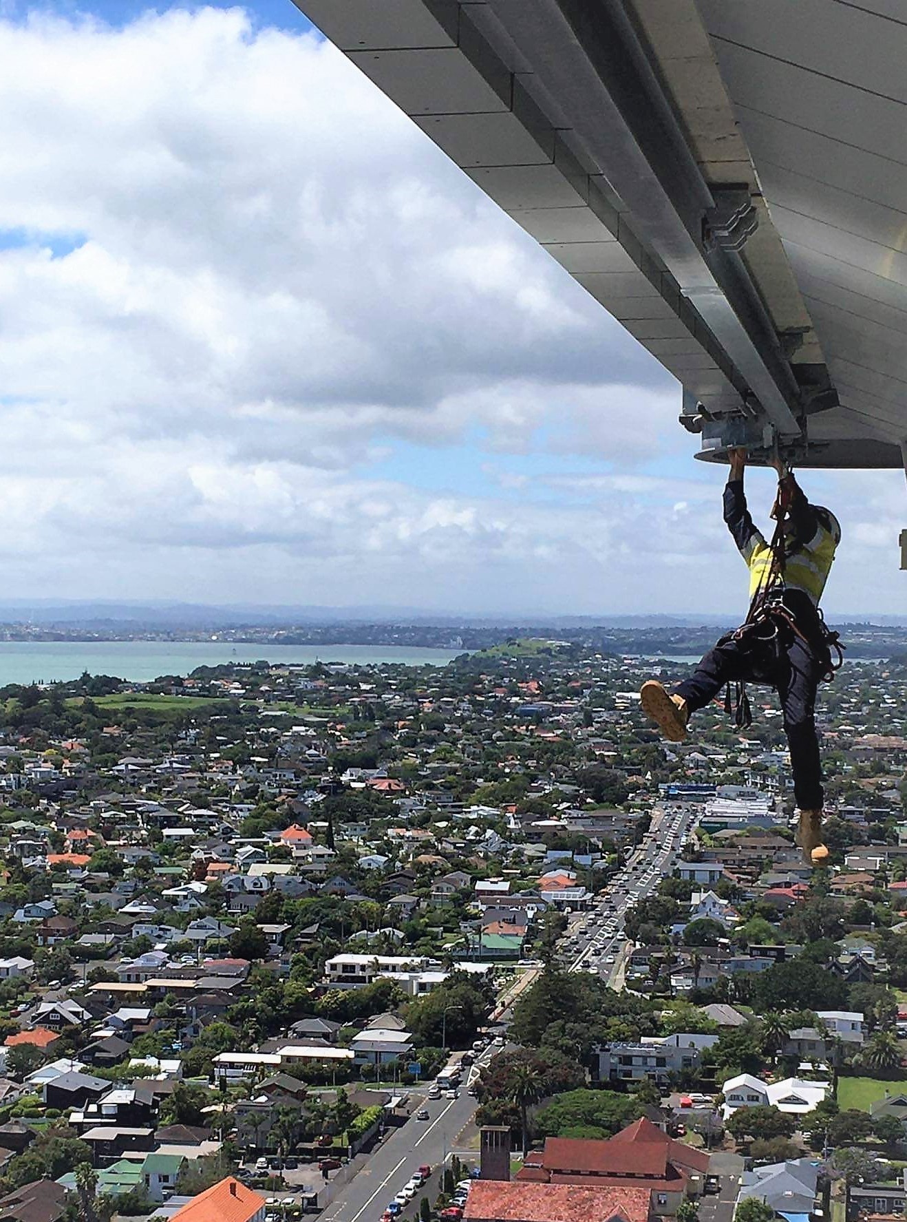
A harnessed worker under the overhand from a highrise doing maintenance work

Access

Step 01

If access is a challenge to your project, I.A Solutions provides the solution. Our point of difference is combining rope access, height safety and specialist systems to deliver safe, efficient results.

Access

Step 01

If access is a challenge to your project, I.A Solutions provides the solution. Our point of difference is combining rope access, height safety and specialist systems to deliver safe, efficient results.

Access

Step 01

If access is a challenge to your project, I.A Solutions provides the solution. Our point of difference is combining rope access, height safety and specialist systems to deliver safe, efficient results.

Inspect

Step 02

Certified inspectors use advanced techniques such as NDT, thermography, and drone surveys to provide accurate data for smarter asset management decisions.

Inspect

Step 02

Certified inspectors use advanced techniques such as NDT, thermography, and drone surveys to provide accurate data for smarter asset management decisions.

Inspect

Step 02

Certified inspectors use advanced techniques such as NDT, thermography, and drone surveys to provide accurate data for smarter asset management decisions.

Maintain

Step 03

Our trade-qualified teams carry out specialist repairs and remedial works, restoring integrity and extending asset life while ensuring full compliance.

Maintain

Step 03

Our trade-qualified teams carry out specialist repairs and remedial works, restoring integrity and extending asset life while ensuring full compliance.

Maintain

Step 03

Our trade-qualified teams carry out specialist repairs and remedial works, restoring integrity and extending asset life while ensuring full compliance.

Frequently Asked Questions

When is a drone survey better than close contact inspection?

When is a drone survey better than close contact inspection?

What do we receive at the end of a survey?

What do we receive at the end of a survey?

Is the defect detection reviewed by a person?

Is the defect detection reviewed by a person?

Can you survey a site that is still operating?

Can you survey a site that is still operating?